![]() Before I get started with today’s history fact, I want to let you know that I am participating in the Blogging from A to Z Challenge for April 2014. At the top of my blog you will see a page I have dedicated to this challenge. No need to subscribe separately as these postings will hit my home page just like all my postings. If you read my blog regularly, the only change you will see for the month of April is that the historical facts are not based on the date but based on the letter of the alphabet (yes even X). 26 postings each Monday through Saturday. Sundays are a break day in the challenge but you will still see my date oriented postings on Sundays.
Before I get started with today’s history fact, I want to let you know that I am participating in the Blogging from A to Z Challenge for April 2014. At the top of my blog you will see a page I have dedicated to this challenge. No need to subscribe separately as these postings will hit my home page just like all my postings. If you read my blog regularly, the only change you will see for the month of April is that the historical facts are not based on the date but based on the letter of the alphabet (yes even X). 26 postings each Monday through Saturday. Sundays are a break day in the challenge but you will still see my date oriented postings on Sundays.

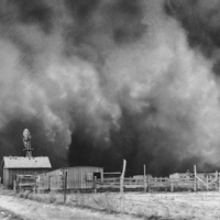
In the spring of 1973, the overflowing Mississippi River reached its highest level
On March 31, 1973, the Mississippi River reaches its peak level in St. Louis during a record 77-day flood. During the extended flood, 33 people died and more than $1 billion in damages were incurred.

The Morganza Spillway, between the Mississippi River and the Atchafalaya Basin, shown while open in 1973. Water flows from the Mississippi (upper right) into the Morganza Floodway (lower left).
The roots of the 1973 flood go back to October 1972, when above-average rain began falling in the river basins that feed the Mississippi River. With more precipitation than normal coming down through the winter, the stage was set for flooding when hard rain came down in March. With most of the Midwest already saturated, the Mississippi began rising slowly to flood levels.
By the middle of March, flood waters began inundating some communities along the Mississippi. The worst of it came in early April when 6 million acres south of St. Louis, Missouri, were claimed by the river and many levees crumbled and failed.

Aerial view of the flood waters in Morgan City, Louisiana May, 1973
As they moved downstream, the rising waters threatened the city of New Orleans. Officials decided to divert some of the water to Lake Ponchartrain and the Gulf of Mexico. This ended the threat to New Orleans, but came at the expense of hundreds of farms in the area. In some areas, the floods continued until June.
Floods of this type are not typically as deadly as flash floods because there is sufficient warning and time to evacuate flood regions. Those who died in this instance were largely residents who had resisted evacuation orders. Still, the flood devastated the economy of the region, as very few families had flood insurance and millions of acres of farm land were unusable for a full year following the flood.
The 1973 flood was not the first and it has not been the last major flooding of the Mississippi River. Here are some noteworthy floods previous and subsequent to the 1973 disaster.
Great Flood of 1844
The largest flood ever recorded on the Missouri River and Upper Mississippi River in terms of discharge. This flood was particularly devastating since the region had few if any levees at the time. Among the hardest hit were the Wyandot who lost 100 people in the diseases that occurred after the flood. The flood also is the highest recorded for the Mississippi River at St. Louis. After the flood, Congress in 1849 passed the Swamp Act providing land grants to build stronger levees.
Great Mississippi Flood of 1927

The Great Mississippi Flood of 1927, Arkansas City, Arkansas.
The 1927 flood was the greatest flood in modern history on the lower Mississippi River. In the summer of 1926 until the spring of 1927, heavy rains fell in eastern Kansas, Oklahoma, and the Ohio Valley. The White and Little Red rivers broke through the levees in Arkansas in February, flooding over 400 km2 (99,000 acres) with 3 to 5 m (9.8 to 16.4 ft) of water. The first levee break along the Mississippi River occurred a few miles south of Elaine, Arkansas on March 29. Over the next six weeks, numerous levees broke along the Mississippi River from Illinois to Louisiana, which inundated numerous towns in the Mississippi Valley. The break at Mounds Landing near Greenville, Mississippi was the single greatest crevasse to ever occur along the Mississippi River. It flooded an area 80 km (50 mi) wide and 160 km (99 mi) long with up to 6 metres (20 ft) of water. Heavy spring rains caused a second major flood in the same region that June. In all, 73,500 km2 (28,400 sq mi) which were home to more than 931,000 people were inundated. To avoid flooding the city of New Orleans, the governor of Louisiana allowed engineers to create the Poydras cut, which saved the city but led to the flooding of St. Bernard and Plaquemines parishes instead. Millions of acres across seven states were flooded. Evacuees totaled 500,000. Economic losses were estimated at US$1 billion (1927 dollars), which was equivalent to almost one-third of the federal budget at that time.
Lower Mississippi Flood of 1983
The flood between May and June was the second most severe flood in the lower Mississippi Basin since 1927. Red River Landing, Louisiana, reached the 4th highest crest of record at 60.52 feet (18.45 m) on June 5 and was flooded for 115 days. All bays of the Bonnet Carre Spillway were opened for 35 days.
Great Mississippi and Missouri Rivers Flood of 1993

Great Flood of 1993, with the Mississippi River out of its banks in Festus, Missouri.
The flood occurred on the Mississippi and Missouri rivers and their tributaries between April to October 1993. The flooded area totaled around 30,000 square miles (80,000 km²)[9] and was the worst since the Great Mississippi Flood of 1927 as measured by duration, square miles inundated, persons displaced, crop and property damage and number of record river levels.
Great Mississippi Flood of 2011

Old train depot along the Mississippi River in Vicksburg, Mississippi., May 13, 2011.
The Mississippi River floods in April and May 2011 were among the largest and most damaging along the U.S. waterway in the past century, rivalling major floods in 1927 and 1993. In April 2011, two major storm systems dumped record rainfall on the Mississippi River watershed. Rising from springtime snowmelt, the river and many of its tributaries began to swell to record levels by the beginning of May. Areas along the Mississippi itself experiencing flooding include Illinois, Iowa, Missouri, Kentucky, Tennessee, Arkansas, Mississippi, and Louisiana. U.S. President Barack Obama declared the western counties of Kentucky, Tennessee, and Mississippi federal disaster areas.For the first time in 38 years, the Morganza Spillway has been opened, deliberately flooding 4,600 square miles (12,000 km2) of rural Louisiana to save most of Baton Rouge and New Orleans.
 – A Father’s Untold War Story") Check out my other blog
Check out my other blog I'M PUBLISHED
 I'm Published Again