The Atchafalaya Basin is huge and its habitats are complex. Besides the main channel of the Atchafalaya River that runs the length of it, the Basin has major and minor bayous, pipeline and oilfield canals, sloughs, coves, lakes and back-swamps.
The northern Basin is different than the central Basin, and the central Basin is different than the southern Basin.
During the months-long floods of spring, what is land turns to water.
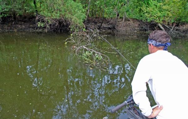
Rhett Buteau has, through trial and error, narrowed down his focus to approximately 50 spots. Much of his fishing is done in man-made canals.
“The main thing about the basin is watching water levels,” Buteau explained. “I fish it as the water falls and when it’s on a stand after the fall.
“When the river is rising, I shift my fishing to the marshes of lower Terrebonne and St. Mary parishes, and to the area outside the eastern levees, including Lake Verret and Bayou Corne.”
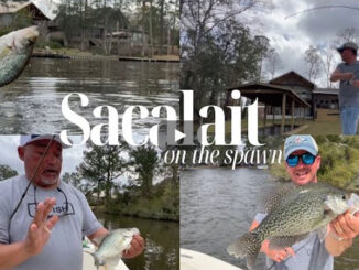
Buteau calls the green water he likes to fish “sac-a-lait water.”
“It’s the black water coming out of the swamps when the river is falling mixing with the brown canal water that makes sac-a-lait water,” he said.
However, almost sacrilegiously, Buteau doesn’t consider water color a critical factor.
“To me, water color isn’t make-you-or-break-you,” he said. “It’s what the water is doing that’s important. Most people consider being able to see your jig 8 inches down as ideal
“If water movement is right, I will catch them in 3 inches of visibility or 18 inches of visibility.”
Understanding how to decipher the swamp’s water level is critical.
“The (Atchafalaya River) gauge at Butte La Rose is the key Basin gauge, but it can fool you,” Buteau said. “You also have to watch the (Mississippi River) Cairo gauge. What happens there will happen in the Basin in one week.
“For example, you can make a great trip with the water at a certain level at Butte La Rose and make a trip later when it’s at the same level and do poorly because the river is behaving differently — rising instead of falling.
“I check the water levels at Cairo and Butte Larose every day.”
The Atchafalaya Basin, as Buteau fishes it, is 52 miles from the I-10 bridge south to Morgan City. Although he acknowledged that fishing begins to heat up when the Butte La Rose gauge is at 10 feet, no one reading is good for determining when every spot in the Basin is at its best.
So the skilled young angler uses a simple rule of thumb to narrow down his focus.
“I’m a firm believer that you want some bank sticking out of the water,” Buteau explained. “It doesn’t have to be a lot — just some.
“When the water is still high enough to flood the bank, it isn’t ready.”
In the more northern part of the Basin, the banks are higher and become exposed by the retreating water earlier. So as the river drops he shifts his fishing from one place to another.
Through repeated fishing trips, he has memorized at what water level fishing at each spot is best.
Buteau cautioned that sometimes canals that are very close to each other will turn on at different times simply because the banks along one will be higher than those of the other.